Archaeology - Magnetometer Survey Solutions
MEASURE
We supply non-destructive methods to digitize hundreds of hectare of landscape in shortest time but within a centimetre precision.
DETECT
With our software we turn raw data into shapes and structures unveiling the past and its secrets.
PROTECT
We help to narrow down excavation work, to create links towards a bigger picture and preserve the heritage of our ancestors.
Preserve History
Who knows how often we stepped on history not knowing what lies beneathus. SENSYS will tell without destructing the ground. With data we turn landscape into history.
Questions about our Services and Products?
Whether you are seeking for consultancy or already looking for specific technical information – get in contact with us!
Why Archaeology matters
A tremendous work is done to understand how life was in the past, how our ancestors settled and moved on. But still, we only discovered a few percentage of our history and much more heritage is out there to get unveiled.
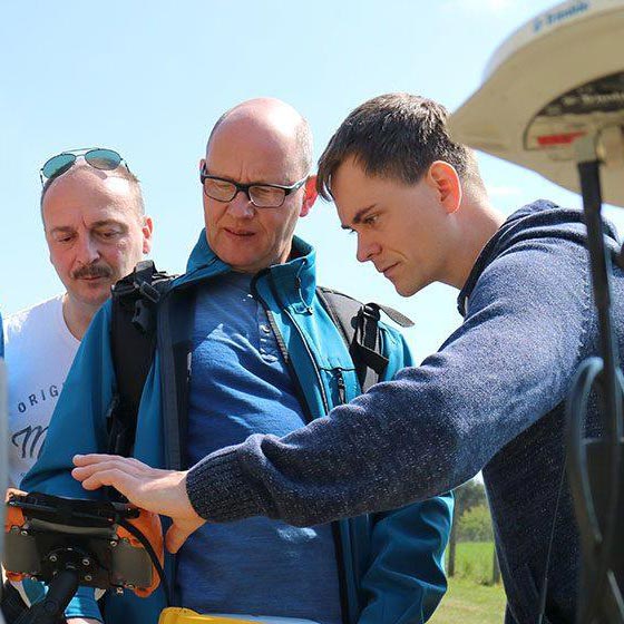
But often, it’s uncertain where to start, where to dig or how get permission to prospect. Methods for non-destructive surveying are required to research on foreign land, agricultural sites or places that permit a disruption of the ground. Luckily, light weight top surface survey systems are available, towed by an ATV with a rack loaded of magnetometers to have a seamless recording; highest data density to make sure no information is left uncovered in the field.
While EOD experts are interested in solid objects signatures, archaeologists are on the outlook for thin lines and faint structures. Combined with a RTK GPS the gathered measurement data can form a highly accurate footprint of an entire area to provide a link between single information. That makes it possible to understand the bigger picture of past settlement and to focus on the right spot, narrow down excavation work and make historical research economical to its environmental impact.
Solutions for geomagnetic prospections
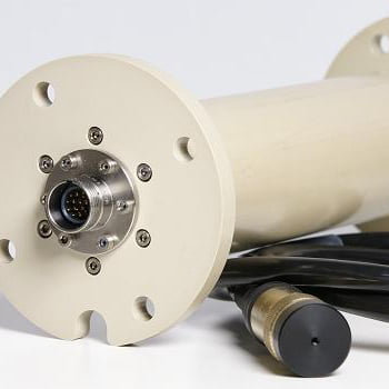
SENSYS pay in to that challenge with its multi sensor systems based Gradiometer or triaxial Magnetometers like the FGM650 ARCH or FGM3D. While the FGM650 ARCH have a reduced measurement range for improved resolutions, the FGM3Ds allows the analysis also of horizontal magnetic components making archaeology a true science.
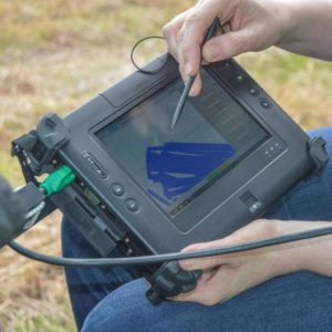
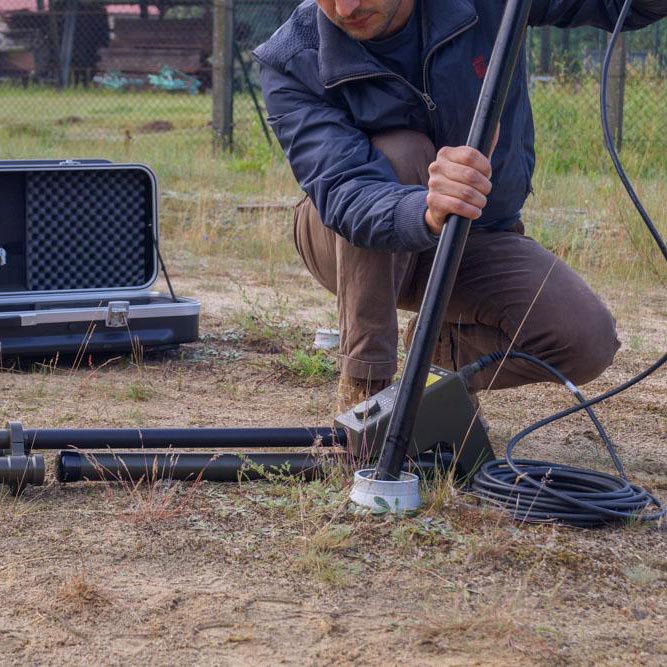
The sensors are put into push cart or vehicle towed systems – like the MXPDA or the MX V3 – that are easy deploy in the field, light weight and intuitive to handle. With a vast number of available GPS solutions, SENSYS systems can hook them up and feeds GPS information directly into the data stream. This way every measurement value is married to a coordinate that is as precise as +/- one centimetre.
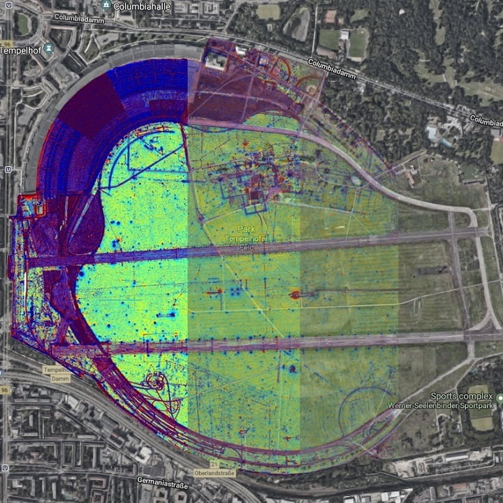
Another benefit of multi sensor solutions is the redundancy of information, whereas the SENSYS processing software MAGNETO® is also comparing and leveraging to deliver a color coded areal map with a superior information level. That way dry river beds, lightning strikes, forging places, ancient roads, fortified barriers and ditches, settlement, graves and houses get visible – even without a single sign if standing in the field right on top of it. While this is all about land, it continues into the water and into the sky to reach places we never thought of before.
Our Products for Archaeology
References from Archaeology field work
OVAI
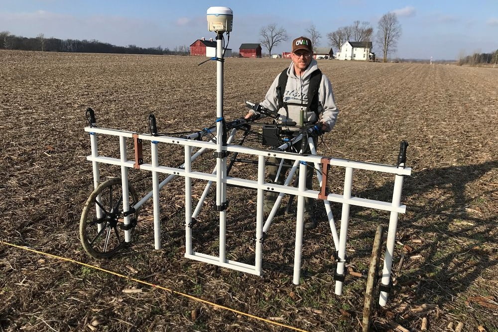
MXPDA in USA
With a broad experience in geophysical methods like Magnetometry, GPR or Resistivity measures, Dr. Jarrod Burks included the MXPDA into his equipment pool to especially scale and improve magnetometer based surveys for their historical field studies in Ohio, but around the globe as well.
Shanarc Archaeology
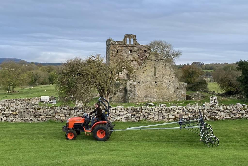
MX V3 in Ireland
Sean Shanarc started to rent a SENSYS magnetometer system for his survey projects, but recognized soon the value of a purchase of an MX V3 with 16 Gradiometers on 25cm sensor distance and RTK DGPS for his field prospection contracts in Archaeology and Geophysics.

University of Warsaw
MX V3 in Poland
With a long track record of prospection and excavation projects within Europe, Michal Pisz used neary any method and technology for historical field surveys. With the SENSYS MX V3 vehicle towed magnetometer system he could increase daily coverage but data density dramatically.
